Radar that moves
like the real sky.
Professional-grade precipitation radar with buttery-smooth playback, lightning, alerts, and forecast frames — across the US, Canada, Europe, and Japan.
Scrub the storm,
frame by frame.

Buttery-smooth animation, frame by frame
Play, pause, step frame-by-frame, or grab the timeline and scrub. Motion stays fluid even at 4× speed, and when a storm is really moving, the rain glides across the map the way it moves in the sky.
- Play / pause, frame stepping, and a draggable timeline scrubber
- Playback speed from 0.5× to 4×
- Loop durations of 1, 3, 6, or 12 hours
- Rain flows along the storm's true direction between frames
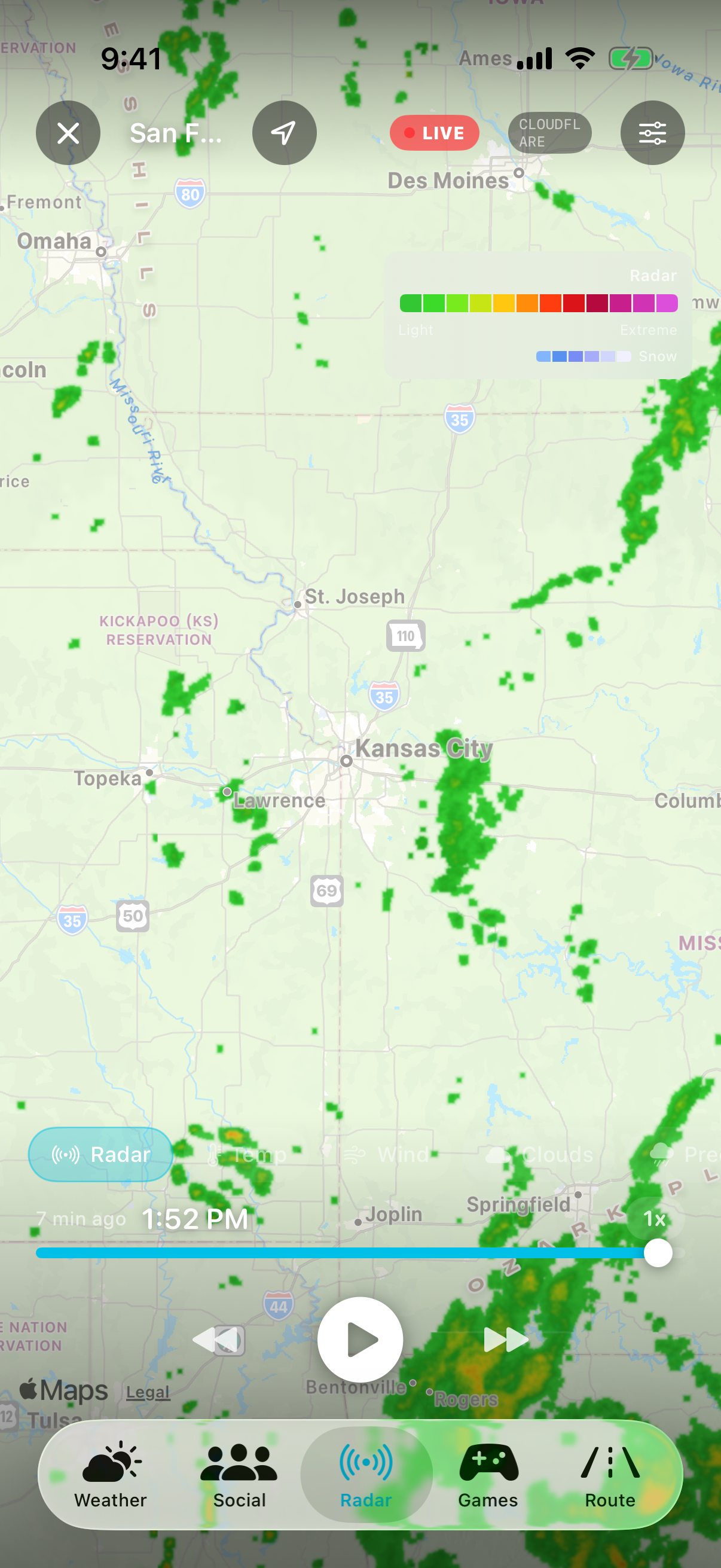
See where the rain is going, not just where it's been
The timeline splits past from future: cyan frames are observed radar, orange frames are the short-term forecast. A LIVE pill marks the newest scan, a FORECAST pill appears the moment you scrub past now — so you always know which side of the present you're looking at.
- Short-term forecast frames extend the loop beyond the present
- LIVE / FORECAST pills make past vs. future unambiguous
- Intensity legend from light rain to extreme, plus a dedicated snow gradient
- Silent auto-refresh keeps the newest frames flowing in every two minutes
Four regions,
one seamless map.
Official radar networks from the US, Canada, Europe, and Japan — blended into a single view. Pan from Kansas to Kyoto without switching sources.