Radar that moves
like the real sky.
Professional-grade precipitation radar with buttery 120 fps playback, lightning, alerts, and forecast frames — rendered on the GPU and streamed from our own radar pipeline.
Scrub the storm,
frame by frame.
Buttery-smooth animation, up to 120 fps
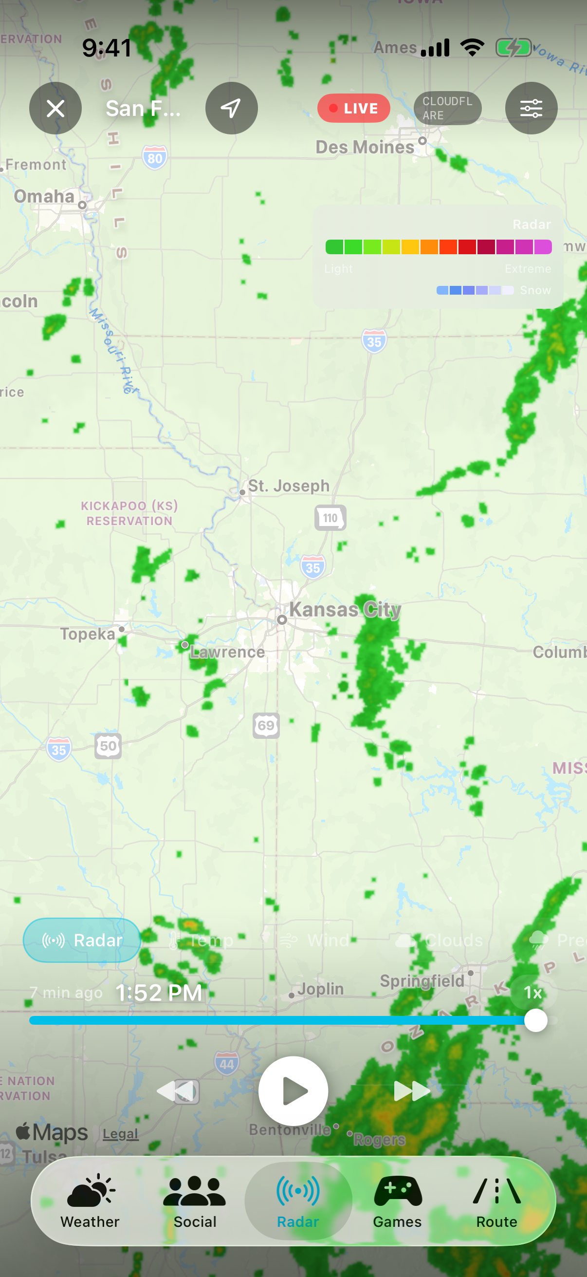
Play, pause, step frame-by-frame, or grab the timeline and scrub. A display-link driver cross-fades sub-frames between radar scans so motion stays fluid even at 4× speed, and storm-motion vectors advect the rain between frames when the storm is really moving.
- Play / pause, frame stepping, and a draggable timeline scrubber
- Playback speed from 0.5× to 4×
- Loop durations of 1, 3, 6, or 12 hours
- Storm-motion interpolation blends frames along the storm's true direction
See where the rain is going, not just where it's been
The timeline splits past from future: cyan frames are observed radar, orange frames are short-term nowcast. A LIVE pill marks the newest scan, a FORECAST pill appears the moment you scrub past now — so you always know which side of the present you're looking at.
- Nowcast forecast frames extend the loop beyond the present
- LIVE / FORECAST pills make past vs. future unambiguous
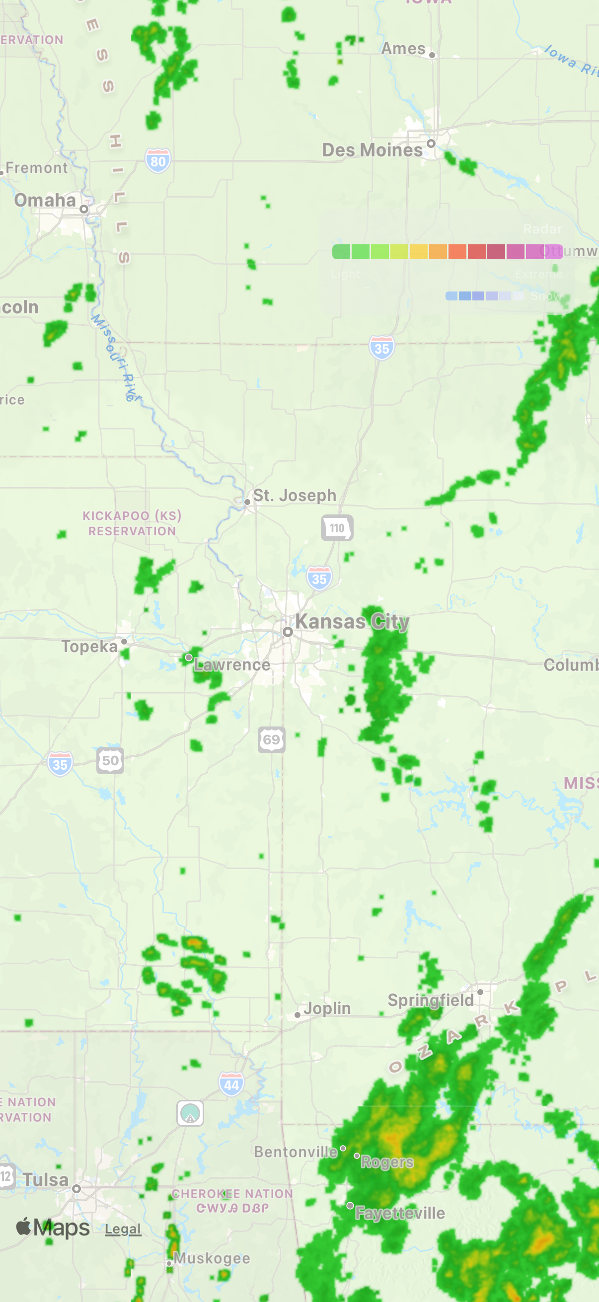
- Intensity legend from light rain to extreme, plus a dedicated snow gradient
- Silent auto-refresh keeps the newest frames flowing in every two minutes
Our own radar pipeline,
edge to edge.
NOAA + Environment Canada, one seamless map
Breeze runs its own radar pipeline at the edge: NOAA's 1-km MRMS mosaic covers the United States, Environment Canada's national radar extends the picture north of the border, and the two are blended per-pixel into a single palette. Zoom out and the rain doesn't stop at the 49th parallel.
- NOAA MRMS 1-km mosaic across the continental US, updated every 2 minutes
- Environment Canada radar merged seamlessly into the same view
- One unified color palette for rain and snow across both sources
- Automatic fallback chain keeps radar flowing if any source hiccups
Everything happening
in the atmosphere.
Lightning Layer
GOES satellite lightning mapperWarnings and strikes, drawn on the map
Flip on the layers you care about from the chip bar. NWS alert polygons render in severity colors with a live count badge, and the lightning layer plots strikes detected from orbit by the GOES Geostationary Lightning Mapper — sized by energy and refreshed every 30 seconds.
- NWS alert polygons within 150 miles, color-coded by type
- Satellite-detected lightning strikes from NOAA GOES, sized by energy
- Temperature, wind, clouds, and precipitation overlay tiles
- Satellite base map toggle for terrain context
Fast because it's
built that way.
Metal GPU Rendering
Tiles decoded on-deviceGPU-rendered, prewarmed, instant
Radar tiles are decoded and colorized on the GPU with Metal, the newest frames are prewarmed in the background before you even open the tab, and the whole UI fades out of your way while you watch the storm. Open the radar and it's just… there.
- Metal-based tile decode and colorization with on-device caching
- Background prewarming so the tab opens with frames already loaded
- Auto-hiding controls for an edge-to-edge, immersive map
- Temperature pills for your saved cities — tap one to jump to its forecast